

Geigelstein parking lot to Breitenstein via Karl – to Walchsee
Geigelstein parking lot - Breitenstein via Karl - Walchsee
distance
duration
highest point
meters upwards
meters downwards
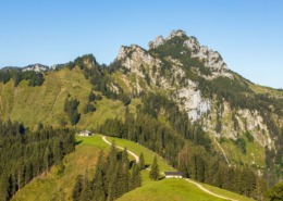
Summit tour. Achental hiking badge Checkpoints: Wuhrsteinalm, Karl; Special features: Karlalm alpine pasture, a paradise for the marmots that live there; chamois on the Breitenstein massif Tip: Pack your swimwear and cool off in Walchsee. Description: At the starting point, the Geigelstein car park in the Schleching district of Ettenhausen, we hike over the so-called “Karl” with the dilapidated Karlalm to the saddle on the Breitstein. Now we climb to the summit of the Breitenstein. On the descent to the destination of Walchsee, we pass through the beautiful Baumgartenalm alpine pasture and return to the valley via the Riederalm. From here, the following two bus connections lead back to Ettenhausen: The first connection goes from Walchsee to Kössen. There we change to the 9509 bus in the direction of Schleching at the VZ Kaiserwinkl stop in the center. After the twelve-minute drive we reach the destination stop in Ettenhausen. From there we walk the last ten minutes back to the starting point, the Geigelstein car park. First bus connection 4030 from (Kufstein) Walchsee to Kössen (Austria): Fahrplan-4030-Kufstein-Koessen-11.12.2022.pdf (k-mobil.eu) Second bus connection 9509 from Kössen to Schleching (cross-border Ö – D): https://www.dbregiobus-bayern.de
 https://www.achental.com/en/storage/sites/10/2024/11/3cBMJGbVQjuArEHVWDZYZ3qcFakrOd8IToiuQfwm-scaled.jpg
1707
2560
admin
https://www.achental.com/wp-content/uploads/2022/07/achental-logo-weiss-horizontal-RGB@2x.png
admin2024-11-06 09:24:352024-11-11 12:09:02Piesenhausener Hochalm
https://www.achental.com/en/storage/sites/10/2024/11/3cBMJGbVQjuArEHVWDZYZ3qcFakrOd8IToiuQfwm-scaled.jpg
1707
2560
admin
https://www.achental.com/wp-content/uploads/2022/07/achental-logo-weiss-horizontal-RGB@2x.png
admin2024-11-06 09:24:352024-11-11 12:09:02Piesenhausener Hochalm https://www.achental.com/en/storage/sites/10/2024/11/53357_DSC00015.jpg
1536
2048
admin
https://www.achental.com/wp-content/uploads/2022/07/achental-logo-weiss-horizontal-RGB@2x.png
admin2024-10-28 11:30:442024-11-11 12:20:54Lake Taubensee via Luftboden- and Kroatensteig
https://www.achental.com/en/storage/sites/10/2024/11/53357_DSC00015.jpg
1536
2048
admin
https://www.achental.com/wp-content/uploads/2022/07/achental-logo-weiss-horizontal-RGB@2x.png
admin2024-10-28 11:30:442024-11-11 12:20:54Lake Taubensee via Luftboden- and Kroatensteig https://www.achental.com/en/storage/sites/10/2024/11/54048_DSC00077.jpg
1536
2048
admin
https://www.achental.com/wp-content/uploads/2022/07/achental-logo-weiss-horizontal-RGB@2x.png
admin2024-10-28 11:30:432024-11-11 11:56:05Chiemseeblick und Kruchenhausener Runde
https://www.achental.com/en/storage/sites/10/2024/11/54048_DSC00077.jpg
1536
2048
admin
https://www.achental.com/wp-content/uploads/2022/07/achental-logo-weiss-horizontal-RGB@2x.png
admin2024-10-28 11:30:432024-11-11 11:56:05Chiemseeblick und Kruchenhausener Runde https://www.achental.com/en/storage/sites/10/2024/11/CDTMsg4Hb2DS5BtnZcYGmBuAfCyveA4EbBoRaaeb-scaled.jpg
1840
2560
admin
https://www.achental.com/wp-content/uploads/2022/07/achental-logo-weiss-horizontal-RGB@2x.png
admin2024-10-28 11:30:232024-11-11 12:00:51Valley circular trail
https://www.achental.com/en/storage/sites/10/2024/11/CDTMsg4Hb2DS5BtnZcYGmBuAfCyveA4EbBoRaaeb-scaled.jpg
1840
2560
admin
https://www.achental.com/wp-content/uploads/2022/07/achental-logo-weiss-horizontal-RGB@2x.png
admin2024-10-28 11:30:232024-11-11 12:00:51Valley circular trail https://www.achental.com/en/storage/sites/10/2024/11/VVT8YD8z5ZEAzoiXkshUne9HdSbxdwHaAkTvV3bW-scaled.jpg
1919
2560
admin
https://www.achental.com/wp-content/uploads/2022/07/achental-logo-weiss-horizontal-RGB@2x.png
admin2024-10-28 11:30:222024-11-11 12:00:15Grießelberg-Rundweg
https://www.achental.com/en/storage/sites/10/2024/11/VVT8YD8z5ZEAzoiXkshUne9HdSbxdwHaAkTvV3bW-scaled.jpg
1919
2560
admin
https://www.achental.com/wp-content/uploads/2022/07/achental-logo-weiss-horizontal-RGB@2x.png
admin2024-10-28 11:30:222024-11-11 12:00:15Grießelberg-Rundweg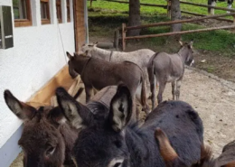 https://www.achental.com/en/storage/sites/10/2024/11/9VruSXPV8ePSxZlnGpViGMZqYnWT2WmVj6N21gVK.webp
768
576
admin
https://www.achental.com/wp-content/uploads/2022/07/achental-logo-weiss-horizontal-RGB@2x.png
admin2024-10-28 11:30:192024-11-11 11:57:18Feldlahnalm tour
https://www.achental.com/en/storage/sites/10/2024/11/9VruSXPV8ePSxZlnGpViGMZqYnWT2WmVj6N21gVK.webp
768
576
admin
https://www.achental.com/wp-content/uploads/2022/07/achental-logo-weiss-horizontal-RGB@2x.png
admin2024-10-28 11:30:192024-11-11 11:57:18Feldlahnalm tour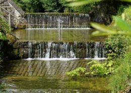 https://www.achental.com/en/storage/sites/10/2024/11/dnnXUqmOoT9qsZJ2w9KjLhaU9rm1fN1Pzba35MkA.jpg
1500
1000
admin
https://www.achental.com/wp-content/uploads/2022/07/achental-logo-weiss-horizontal-RGB@2x.png
admin2024-10-28 11:30:172024-11-11 12:05:36Kneipp circular tour
https://www.achental.com/en/storage/sites/10/2024/11/dnnXUqmOoT9qsZJ2w9KjLhaU9rm1fN1Pzba35MkA.jpg
1500
1000
admin
https://www.achental.com/wp-content/uploads/2022/07/achental-logo-weiss-horizontal-RGB@2x.png
admin2024-10-28 11:30:172024-11-11 12:05:36Kneipp circular tour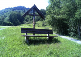 https://www.achental.com/en/storage/sites/10/2024/11/89256_DSC00025.jpg
1536
2048
admin
https://www.achental.com/wp-content/uploads/2022/07/achental-logo-weiss-horizontal-RGB@2x.png
admin2024-10-25 15:47:522024-11-11 12:11:00Circular hike Hinterwössen
https://www.achental.com/en/storage/sites/10/2024/11/89256_DSC00025.jpg
1536
2048
admin
https://www.achental.com/wp-content/uploads/2022/07/achental-logo-weiss-horizontal-RGB@2x.png
admin2024-10-25 15:47:522024-11-11 12:11:00Circular hike Hinterwössen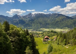 https://www.achental.com/en/storage/sites/10/2024/11/sI0JyHhoSTI8r8TCYiee1ydZojiMieRrirnifIF6-scaled.jpg
1707
2560
admin
https://www.achental.com/wp-content/uploads/2022/07/achental-logo-weiss-horizontal-RGB@2x.png
admin2024-10-25 15:47:352024-11-11 11:52:40Auf historischen Pfaden
https://www.achental.com/en/storage/sites/10/2024/11/sI0JyHhoSTI8r8TCYiee1ydZojiMieRrirnifIF6-scaled.jpg
1707
2560
admin
https://www.achental.com/wp-content/uploads/2022/07/achental-logo-weiss-horizontal-RGB@2x.png
admin2024-10-25 15:47:352024-11-11 11:52:40Auf historischen Pfaden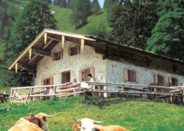 https://www.achental.com/en/storage/sites/10/2024/11/88895_Staudacher_Alm.jpg
353
621
admin
https://www.achental.com/wp-content/uploads/2022/07/achental-logo-weiss-horizontal-RGB@2x.png
admin2024-10-25 15:43:292024-11-11 12:26:16Hike to Staudacher Alm
https://www.achental.com/en/storage/sites/10/2024/11/88895_Staudacher_Alm.jpg
353
621
admin
https://www.achental.com/wp-content/uploads/2022/07/achental-logo-weiss-horizontal-RGB@2x.png
admin2024-10-25 15:43:292024-11-11 12:26:16Hike to Staudacher Alm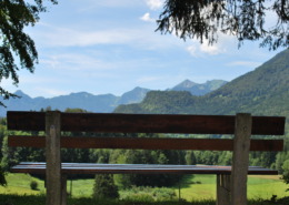 https://www.achental.com/en/storage/sites/10/2024/11/51266_Bank_mit_Aussicht_-_Minaruh-scaled.jpg
1714
2560
admin
https://www.achental.com/wp-content/uploads/2022/07/achental-logo-weiss-horizontal-RGB@2x.png
admin2024-10-01 17:50:352024-11-11 11:58:07River and moor hike through the Achental
https://www.achental.com/en/storage/sites/10/2024/11/51266_Bank_mit_Aussicht_-_Minaruh-scaled.jpg
1714
2560
admin
https://www.achental.com/wp-content/uploads/2022/07/achental-logo-weiss-horizontal-RGB@2x.png
admin2024-10-01 17:50:352024-11-11 11:58:07River and moor hike through the Achental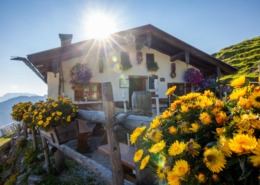 https://www.achental.com/en/storage/sites/10/2024/11/Te2tS4q2ZNk5iEXddzTbag4xoStiEYcopEfwl9o0-scaled.jpg
1707
2560
admin
https://www.achental.com/wp-content/uploads/2022/07/achental-logo-weiss-horizontal-RGB@2x.png
admin2024-10-01 17:50:342024-11-11 11:51:38Almwanderung zur Rechenberg-Alm
https://www.achental.com/en/storage/sites/10/2024/11/Te2tS4q2ZNk5iEXddzTbag4xoStiEYcopEfwl9o0-scaled.jpg
1707
2560
admin
https://www.achental.com/wp-content/uploads/2022/07/achental-logo-weiss-horizontal-RGB@2x.png
admin2024-10-01 17:50:342024-11-11 11:51:38Almwanderung zur Rechenberg-Alm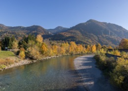 https://www.achental.com/en/storage/sites/10/2024/11/EH3CPTXurhRqZOwEUt1orWVrTFXkfhD2LU1KWGzY-scaled.jpg
1708
2560
admin
https://www.achental.com/wp-content/uploads/2022/07/achental-logo-weiss-horizontal-RGB@2x.png
admin2024-10-01 17:50:332024-11-11 12:11:39Circular tour to Marquartstein castle and river Tiroler Ache dam
https://www.achental.com/en/storage/sites/10/2024/11/EH3CPTXurhRqZOwEUt1orWVrTFXkfhD2LU1KWGzY-scaled.jpg
1708
2560
admin
https://www.achental.com/wp-content/uploads/2022/07/achental-logo-weiss-horizontal-RGB@2x.png
admin2024-10-01 17:50:332024-11-11 12:11:39Circular tour to Marquartstein castle and river Tiroler Ache dam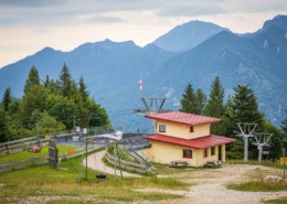 https://www.achental.com/en/storage/sites/10/2024/11/N2bNvLXAlAVqBVUmhM8WBwzY1qUKdpLbN0RQxYkn-scaled.jpg
1707
2560
admin
https://www.achental.com/wp-content/uploads/2022/07/achental-logo-weiss-horizontal-RGB@2x.png
admin2024-10-01 17:50:322024-11-11 12:12:18Circular trail Zeppelinhöhe
https://www.achental.com/en/storage/sites/10/2024/11/N2bNvLXAlAVqBVUmhM8WBwzY1qUKdpLbN0RQxYkn-scaled.jpg
1707
2560
admin
https://www.achental.com/wp-content/uploads/2022/07/achental-logo-weiss-horizontal-RGB@2x.png
admin2024-10-01 17:50:322024-11-11 12:12:18Circular trail Zeppelinhöhe https://www.achental.com/en/storage/sites/10/2024/11/eF5RWwpHLyZRBXIEDfQQZANZgDDIFpK9upEuLTMb-scaled.jpg
1919
2560
admin
https://www.achental.com/wp-content/uploads/2022/07/achental-logo-weiss-horizontal-RGB@2x.png
admin2024-10-01 17:50:312024-11-11 12:10:05Around Marquartstein castle
https://www.achental.com/en/storage/sites/10/2024/11/eF5RWwpHLyZRBXIEDfQQZANZgDDIFpK9upEuLTMb-scaled.jpg
1919
2560
admin
https://www.achental.com/wp-content/uploads/2022/07/achental-logo-weiss-horizontal-RGB@2x.png
admin2024-10-01 17:50:312024-11-11 12:10:05Around Marquartstein castle https://www.achental.com/wp-content/uploads/2022/07/achental-logo-weiss-horizontal-RGB@2x.png
0
0
admin
https://www.achental.com/wp-content/uploads/2022/07/achental-logo-weiss-horizontal-RGB@2x.png
admin2024-10-01 17:50:312024-11-11 12:11:13Rundweg Schnappenwinkl – Staudach
https://www.achental.com/wp-content/uploads/2022/07/achental-logo-weiss-horizontal-RGB@2x.png
0
0
admin
https://www.achental.com/wp-content/uploads/2022/07/achental-logo-weiss-horizontal-RGB@2x.png
admin2024-10-01 17:50:312024-11-11 12:11:13Rundweg Schnappenwinkl – Staudach https://www.achental.com/en/storage/sites/10/2024/11/BB6c390WBwrPa41LKQngrCwHVl0PRm8DcXUWGi0u-scaled.jpg
1707
2560
admin
https://www.achental.com/wp-content/uploads/2022/07/achental-logo-weiss-horizontal-RGB@2x.png
admin2024-10-01 17:50:272024-11-11 12:24:38To Unterwössen along Tiroler Ache and Richard-Strauss Höhenweg )
https://www.achental.com/en/storage/sites/10/2024/11/BB6c390WBwrPa41LKQngrCwHVl0PRm8DcXUWGi0u-scaled.jpg
1707
2560
admin
https://www.achental.com/wp-content/uploads/2022/07/achental-logo-weiss-horizontal-RGB@2x.png
admin2024-10-01 17:50:272024-11-11 12:24:38To Unterwössen along Tiroler Ache and Richard-Strauss Höhenweg ) https://www.achental.com/en/storage/sites/10/2024/11/VhHN4nXmW8xKONAeuQqQjojDTSMjF3WQttzza5NH-scaled.jpg
1707
2560
admin
https://www.achental.com/wp-content/uploads/2022/07/achental-logo-weiss-horizontal-RGB@2x.png
admin2024-10-01 17:50:272024-11-11 12:15:16Schnappenkirche
https://www.achental.com/en/storage/sites/10/2024/11/65WXYhJdPWmJTz4k5TUHiKCTixL2EgZmb2hAPpa1-scaled.jpg
1919
2560
admin
https://www.achental.com/wp-content/uploads/2022/07/achental-logo-weiss-horizontal-RGB@2x.png
admin2024-10-01 17:50:272024-11-11 12:10:47Circular tour via Minaruh and Streunthal
https://www.achental.com/en/storage/sites/10/2024/11/VhHN4nXmW8xKONAeuQqQjojDTSMjF3WQttzza5NH-scaled.jpg
1707
2560
admin
https://www.achental.com/wp-content/uploads/2022/07/achental-logo-weiss-horizontal-RGB@2x.png
admin2024-10-01 17:50:272024-11-11 12:15:16Schnappenkirche
https://www.achental.com/en/storage/sites/10/2024/11/65WXYhJdPWmJTz4k5TUHiKCTixL2EgZmb2hAPpa1-scaled.jpg
1919
2560
admin
https://www.achental.com/wp-content/uploads/2022/07/achental-logo-weiss-horizontal-RGB@2x.png
admin2024-10-01 17:50:272024-11-11 12:10:47Circular tour via Minaruh and Streunthal

 Bike and Hike-Tour via Chiemhauser-Alm to Lake Taubensee