

Summit hike to Hochplatte
Varied summit tour with beautiful views of Lake Chiemsee and the Chiemgau and Tyrolean mountains.

distance
duration
highest point
meters upwards
meters downwards
The hike begins at the mountain station of the Hochplattenbahn. The very well-developed forest path is part of the “E4” (European long-distance hiking trail “Pyrenees-Neusiedler See”) as well as the “Maximiliansweg” and the “Via Alpina”. As an alternative ascent, we first head towards Hochplatte, but after about 800 meters we choose the option to the right via the “Alten Plattenweg”. We soon reach a forest road and immediately after that the entrance to the left towards Hochplatte. It is a relatively demanding path that requires surefootedness. At the end of the path we come back to the forest road and now hike left towards Hochplatte. After a short time we reach the saddle of the Haberspitz, where we climb to the right on a steep section to the summit of the Hochplatte. After about half an hour we reach the summit cross and can enjoy the wonderful panoramic view of the Chiemgau and the surrounding mountains. In good weather, the view extends far into the Alps and into Austria. On the way back we hike from the saddle downhill to the right, pass the Hochplattenbahn and reach the starting point of our hike again. Refreshment option: Staffn Alm (small detour).
 https://www.achental.com/en/storage/sites/10/2025/06/51253_DSC00673_1920x1278.jpg
1278
1920
admin
https://www.achental.com/wp-content/uploads/2022/07/achental-logo-weiss-horizontal-RGB@2x.png
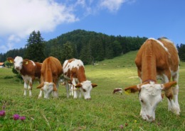
admin2025-04-30 09:21:342025-06-07 11:02:26Circular tour Grassauer Almen
https://www.achental.com/en/storage/sites/10/2025/06/51253_DSC00673_1920x1278.jpg
1278
1920
admin
https://www.achental.com/wp-content/uploads/2022/07/achental-logo-weiss-horizontal-RGB@2x.png
admin2025-04-30 09:21:342025-06-07 11:02:26Circular tour Grassauer Almen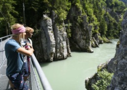 https://www.achental.com/en/storage/sites/10/2025/06/OqqtL2ddEOAljbylKsbGYuTNgwTs5VV03aCmQVk7.jpg
1707
2560
admin
https://www.achental.com/wp-content/uploads/2022/07/achental-logo-weiss-horizontal-RGB@2x.png
admin2025-04-24 01:08:072025-06-07 11:05:29Schmugglerweg to Kössen
https://www.achental.com/en/storage/sites/10/2025/06/OqqtL2ddEOAljbylKsbGYuTNgwTs5VV03aCmQVk7.jpg
1707
2560
admin
https://www.achental.com/wp-content/uploads/2022/07/achental-logo-weiss-horizontal-RGB@2x.png
admin2025-04-24 01:08:072025-06-07 11:05:29Schmugglerweg to Kössen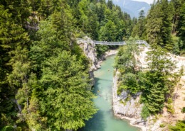 https://www.achental.com/en/storage/sites/10/2025/06/DBEUmwDZxqIa552KGtY7FRaBDy2zuyT3CSJVxLhF.jpg
1705
2560
admin
https://www.achental.com/wp-content/uploads/2022/07/achental-logo-weiss-horizontal-RGB@2x.png
admin2025-04-24 01:08:062025-06-07 11:06:06Schmugglerweg to Klobenstein
https://www.achental.com/en/storage/sites/10/2025/06/DBEUmwDZxqIa552KGtY7FRaBDy2zuyT3CSJVxLhF.jpg
1705
2560
admin
https://www.achental.com/wp-content/uploads/2022/07/achental-logo-weiss-horizontal-RGB@2x.png
admin2025-04-24 01:08:062025-06-07 11:06:06Schmugglerweg to Klobenstein https://www.achental.com/en/storage/sites/10/2025/06/sI0JyHhoSTI8r8TCYiee1ydZojiMieRrirnifIF6.jpg
1707
2560
admin
https://www.achental.com/wp-content/uploads/2022/07/achental-logo-weiss-horizontal-RGB@2x.png
admin2025-04-14 01:03:572025-06-07 10:40:03Auf historischen Pfaden
https://www.achental.com/en/storage/sites/10/2025/06/sI0JyHhoSTI8r8TCYiee1ydZojiMieRrirnifIF6.jpg
1707
2560
admin
https://www.achental.com/wp-content/uploads/2022/07/achental-logo-weiss-horizontal-RGB@2x.png
admin2025-04-14 01:03:572025-06-07 10:40:03Auf historischen Pfaden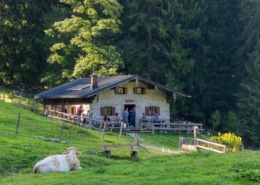 https://www.achental.com/en/storage/sites/10/2025/06/gzzxtE26tAeHfOmQ2Py2gP7DoMAzPHJDquWDsptw.jpg
1707
2560
admin
https://www.achental.com/wp-content/uploads/2022/07/achental-logo-weiss-horizontal-RGB@2x.png
admin2025-04-09 01:11:092025-06-07 11:19:46Schnappenberg – Schnappenkirche
https://www.achental.com/en/storage/sites/10/2025/06/gzzxtE26tAeHfOmQ2Py2gP7DoMAzPHJDquWDsptw.jpg
1707
2560
admin
https://www.achental.com/wp-content/uploads/2022/07/achental-logo-weiss-horizontal-RGB@2x.png
admin2025-04-09 01:11:092025-06-07 11:19:46Schnappenberg – Schnappenkirche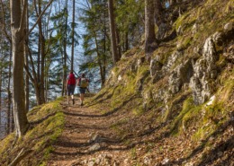 https://www.achental.com/en/storage/sites/10/2025/06/byrz9Rdu4oAN0l849tnGJuWZPJQwfDPf8187HMNO.jpg
1707
2560
admin
https://www.achental.com/wp-content/uploads/2022/07/achental-logo-weiss-horizontal-RGB@2x.png
admin2025-04-09 01:11:092025-06-07 11:09:51Circular hike: Staudacheralm – Schnappenkirche
https://www.achental.com/en/storage/sites/10/2025/06/byrz9Rdu4oAN0l849tnGJuWZPJQwfDPf8187HMNO.jpg
1707
2560
admin
https://www.achental.com/wp-content/uploads/2022/07/achental-logo-weiss-horizontal-RGB@2x.png
admin2025-04-09 01:11:092025-06-07 11:09:51Circular hike: Staudacheralm – Schnappenkirche https://www.achental.com/en/storage/sites/10/2025/06/UkMX7jlNtUgz7DUN7zw7n8VZWRoafD2XjJtGyatW.jpg
1919
2560
admin
https://www.achental.com/wp-content/uploads/2022/07/achental-logo-weiss-horizontal-RGB@2x.png
admin2025-02-24 01:06:162025-06-07 10:49:27Valley circular trail
https://www.achental.com/en/storage/sites/10/2025/06/UkMX7jlNtUgz7DUN7zw7n8VZWRoafD2XjJtGyatW.jpg
1919
2560
admin
https://www.achental.com/wp-content/uploads/2022/07/achental-logo-weiss-horizontal-RGB@2x.png
admin2025-02-24 01:06:162025-06-07 10:49:27Valley circular trail https://www.achental.com/en/storage/sites/10/2025/06/9VruSXPV8ePSxZlnGpViGMZqYnWT2WmVj6N21gVK.webp
768
576
admin
https://www.achental.com/wp-content/uploads/2022/07/achental-logo-weiss-horizontal-RGB@2x.png
admin2025-02-19 01:04:142025-06-07 10:45:19Feldlahnalm tour
https://www.achental.com/en/storage/sites/10/2025/06/9VruSXPV8ePSxZlnGpViGMZqYnWT2WmVj6N21gVK.webp
768
576
admin
https://www.achental.com/wp-content/uploads/2022/07/achental-logo-weiss-horizontal-RGB@2x.png
admin2025-02-19 01:04:142025-06-07 10:45:19Feldlahnalm tour https://www.achental.com/wp-content/uploads/2022/07/achental-logo-weiss-horizontal-RGB@2x.png
0
0
admin
https://www.achental.com/wp-content/uploads/2022/07/achental-logo-weiss-horizontal-RGB@2x.png
admin2025-01-01 01:04:262025-06-07 11:13:58Lake Taubensee via Luftboden- and Kroatensteig
https://www.achental.com/wp-content/uploads/2022/07/achental-logo-weiss-horizontal-RGB@2x.png
0
0
admin
https://www.achental.com/wp-content/uploads/2022/07/achental-logo-weiss-horizontal-RGB@2x.png
admin2025-01-01 01:04:262025-06-07 11:13:58Lake Taubensee via Luftboden- and Kroatensteig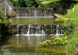 https://www.achental.com/en/storage/sites/10/2025/06/dnnXUqmOoT9qsZJ2w9KjLhaU9rm1fN1Pzba35MkA.jpg
1500
1000
admin
https://www.achental.com/wp-content/uploads/2022/07/achental-logo-weiss-horizontal-RGB@2x.png
admin2025-01-01 01:04:242025-06-07 10:55:06Kneipp circular tour
https://www.achental.com/wp-content/uploads/2022/07/achental-logo-weiss-horizontal-RGB@2x.png
0
0
admin
https://www.achental.com/wp-content/uploads/2022/07/achental-logo-weiss-horizontal-RGB@2x.png
admin2025-01-01 01:04:232025-06-07 11:01:38Rundweg Schnappenwinkl – Staudach
https://www.achental.com/wp-content/uploads/2022/07/achental-logo-weiss-horizontal-RGB@2x.png
0
0
admin
https://www.achental.com/wp-content/uploads/2022/07/achental-logo-weiss-horizontal-RGB@2x.png
admin2025-01-01 01:04:222025-06-07 10:46:09River and moor hike through the Achental
https://www.achental.com/en/storage/sites/10/2025/06/dnnXUqmOoT9qsZJ2w9KjLhaU9rm1fN1Pzba35MkA.jpg
1500
1000
admin
https://www.achental.com/wp-content/uploads/2022/07/achental-logo-weiss-horizontal-RGB@2x.png
admin2025-01-01 01:04:242025-06-07 10:55:06Kneipp circular tour
https://www.achental.com/wp-content/uploads/2022/07/achental-logo-weiss-horizontal-RGB@2x.png
0
0
admin
https://www.achental.com/wp-content/uploads/2022/07/achental-logo-weiss-horizontal-RGB@2x.png
admin2025-01-01 01:04:232025-06-07 11:01:38Rundweg Schnappenwinkl – Staudach
https://www.achental.com/wp-content/uploads/2022/07/achental-logo-weiss-horizontal-RGB@2x.png
0
0
admin
https://www.achental.com/wp-content/uploads/2022/07/achental-logo-weiss-horizontal-RGB@2x.png
admin2025-01-01 01:04:222025-06-07 10:46:09River and moor hike through the Achental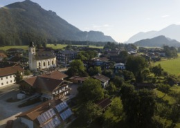 https://www.achental.com/en/storage/sites/10/2025/06/VVT8YD8z5ZEAzoiXkshUne9HdSbxdwHaAkTvV3bW.jpg
1919
2560
admin
https://www.achental.com/wp-content/uploads/2022/07/achental-logo-weiss-horizontal-RGB@2x.png
admin2025-01-01 01:04:212025-06-07 10:48:46Grießelberg-Rundweg
https://www.achental.com/en/storage/sites/10/2025/06/VVT8YD8z5ZEAzoiXkshUne9HdSbxdwHaAkTvV3bW.jpg
1919
2560
admin
https://www.achental.com/wp-content/uploads/2022/07/achental-logo-weiss-horizontal-RGB@2x.png
admin2025-01-01 01:04:212025-06-07 10:48:46Grießelberg-Rundweg https://www.achental.com/en/storage/sites/10/2025/06/89256_DSC00025.jpg
1536
2048
admin
https://www.achental.com/wp-content/uploads/2022/07/achental-logo-weiss-horizontal-RGB@2x.png
admin2025-01-01 01:04:192025-06-07 11:01:24Circular hike Hinterwössen
https://www.achental.com/en/storage/sites/10/2025/06/89256_DSC00025.jpg
1536
2048
admin
https://www.achental.com/wp-content/uploads/2022/07/achental-logo-weiss-horizontal-RGB@2x.png
admin2025-01-01 01:04:192025-06-07 11:01:24Circular hike Hinterwössen https://www.achental.com/en/storage/sites/10/2025/06/oVwKyuBPBxd4hb8dx2dB9cYkwxVcsjkJrcGgNKx1.jpg
543
768
admin
https://www.achental.com/wp-content/uploads/2022/07/achental-logo-weiss-horizontal-RGB@2x.png
admin2025-01-01 01:04:182025-06-07 10:47:04Geigelstein parking lot to Breitenstein via Karl – to Walchsee
https://www.achental.com/en/storage/sites/10/2025/06/oVwKyuBPBxd4hb8dx2dB9cYkwxVcsjkJrcGgNKx1.jpg
543
768
admin
https://www.achental.com/wp-content/uploads/2022/07/achental-logo-weiss-horizontal-RGB@2x.png
admin2025-01-01 01:04:182025-06-07 10:47:04Geigelstein parking lot to Breitenstein via Karl – to Walchsee https://www.achental.com/en/storage/sites/10/2025/06/wMi70NWgXiYlIFKkdOOpZl1UsbdCQKVH0V6cl5Ni.jpg
1707
2560
admin
https://www.achental.com/wp-content/uploads/2022/07/achental-logo-weiss-horizontal-RGB@2x.png
admin2024-12-30 01:04:102025-06-07 10:41:24Bergwalderlebnisweg Staffen with Hochplattenbahn cable car
https://www.achental.com/en/storage/sites/10/2025/06/wMi70NWgXiYlIFKkdOOpZl1UsbdCQKVH0V6cl5Ni.jpg
1707
2560
admin
https://www.achental.com/wp-content/uploads/2022/07/achental-logo-weiss-horizontal-RGB@2x.png
admin2024-12-30 01:04:102025-06-07 10:41:24Bergwalderlebnisweg Staffen with Hochplattenbahn cable car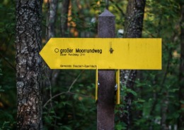 https://www.achental.com/en/storage/sites/10/2025/06/XQIxdrBep4hkkHo5ZkqtPoAaOrd6Xeszaw9QHE3g.jpeg
1080
1616
admin
https://www.achental.com/wp-content/uploads/2022/07/achental-logo-weiss-horizontal-RGB@2x.png
admin2024-12-30 01:04:092025-06-07 10:49:00Long Moorland Path
https://www.achental.com/en/storage/sites/10/2025/06/XQIxdrBep4hkkHo5ZkqtPoAaOrd6Xeszaw9QHE3g.jpeg
1080
1616
admin
https://www.achental.com/wp-content/uploads/2022/07/achental-logo-weiss-horizontal-RGB@2x.png
admin2024-12-30 01:04:092025-06-07 10:49:00Long Moorland Path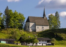 https://www.achental.com/en/storage/sites/10/2025/06/KKX9UDoPV12aMw9wvyEJ367aiX6VkZbBz3SUeNbQ.jpg
1707
2560
admin
https://www.achental.com/wp-content/uploads/2022/07/achental-logo-weiss-horizontal-RGB@2x.png
admin2024-12-30 01:04:092025-06-07 11:16:21Via Chiemhauseralm to church Streichenkirche
https://www.achental.com/en/storage/sites/10/2025/06/KKX9UDoPV12aMw9wvyEJ367aiX6VkZbBz3SUeNbQ.jpg
1707
2560
admin
https://www.achental.com/wp-content/uploads/2022/07/achental-logo-weiss-horizontal-RGB@2x.png
admin2024-12-30 01:04:092025-06-07 11:16:21Via Chiemhauseralm to church Streichenkirche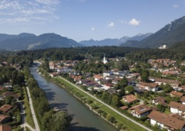 https://www.achental.com/en/storage/sites/10/2025/06/65WXYhJdPWmJTz4k5TUHiKCTixL2EgZmb2hAPpa1.jpg
1919
2560
admin
https://www.achental.com/wp-content/uploads/2022/07/achental-logo-weiss-horizontal-RGB@2x.png
admin2024-12-30 01:04:082025-06-07 11:01:04Circular tour via Minaruh and Streunthal
https://www.achental.com/en/storage/sites/10/2025/06/BB6c390WBwrPa41LKQngrCwHVl0PRm8DcXUWGi0u.jpg
1707
2560
admin
https://www.achental.com/wp-content/uploads/2022/07/achental-logo-weiss-horizontal-RGB@2x.png
admin2024-12-30 01:04:072025-06-07 11:17:54To Unterwössen along Tiroler Ache and Richard-Strauss Höhenweg )
https://www.achental.com/en/storage/sites/10/2025/06/65WXYhJdPWmJTz4k5TUHiKCTixL2EgZmb2hAPpa1.jpg
1919
2560
admin
https://www.achental.com/wp-content/uploads/2022/07/achental-logo-weiss-horizontal-RGB@2x.png
admin2024-12-30 01:04:082025-06-07 11:01:04Circular tour via Minaruh and Streunthal
https://www.achental.com/en/storage/sites/10/2025/06/BB6c390WBwrPa41LKQngrCwHVl0PRm8DcXUWGi0u.jpg
1707
2560
admin
https://www.achental.com/wp-content/uploads/2022/07/achental-logo-weiss-horizontal-RGB@2x.png
admin2024-12-30 01:04:072025-06-07 11:17:54To Unterwössen along Tiroler Ache and Richard-Strauss Höhenweg )

 Circular tour via Minaruh and Streunthal


