

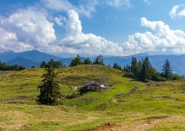
Blasialm-Rundweg
Alm-Rundweg - Shady circular trail on forest roads from the hiking car park Austraße, Blasialm, Geigelstein car park, back to Schlechinger Au

distance
duration
highest point
meters upwards
meters downwards
Alpine pasture circular route Possibility to stop off: noneSpecial features: quiet, secluded tour far away from the hustle and bustleDescription: From the Austrasse hiking car park, take a forest path towards Haidenholzalm. At the first major crossroads, turn left towards Ettenhausen. 200 m above is the Blasialm, which gave this circular route its name. Continuing on, there is a shortcut to Ettenhausen or Schleching via the “Knoglerlahnersteig”, a narrow serpentine path, until signs point the way towards Mühlau or the Austrasse hiking car park. However, if you follow the forest road to the Geigelstein car park with information boards for hiking destinations and circular routes and walk a short distance on the road towards Ettenhausen, the path branches off to the left towards the starting point at the Austrasse hiking car park.Achental hiking pin checkpoints: Blasialm
 https://www.achental.com/en/storage/sites/10/2025/11/Q8hrtcs0fpd23OG0IqfL4csJScbu4hFENdIsS4vB.jpeg
1707
2560
admin
https://www.achental.com/wp-content/uploads/2022/07/achental-logo-weiss-horizontal-RGB@2x.png
admin2025-09-05 01:08:582025-11-09 18:36:01Lake Taubensee Loop – Festsaal
https://www.achental.com/en/storage/sites/10/2025/11/Q8hrtcs0fpd23OG0IqfL4csJScbu4hFENdIsS4vB.jpeg
1707
2560
admin
https://www.achental.com/wp-content/uploads/2022/07/achental-logo-weiss-horizontal-RGB@2x.png
admin2025-09-05 01:08:582025-11-09 18:36:01Lake Taubensee Loop – Festsaal https://www.achental.com/en/storage/sites/10/2025/11/AlPF6RbIW1U1m98MB2QDZ3tKDNqVU6mKoZy6jruc.jpeg
1707
2560
admin
https://www.achental.com/wp-content/uploads/2022/07/achental-logo-weiss-horizontal-RGB@2x.png
admin2025-09-05 01:08:552025-11-09 18:34:08Streichen-Luftbodensteig-Wetterkreuz-Runde mit Wanderbus
https://www.achental.com/en/storage/sites/10/2025/11/AlPF6RbIW1U1m98MB2QDZ3tKDNqVU6mKoZy6jruc.jpeg
1707
2560
admin
https://www.achental.com/wp-content/uploads/2022/07/achental-logo-weiss-horizontal-RGB@2x.png
admin2025-09-05 01:08:552025-11-09 18:34:08Streichen-Luftbodensteig-Wetterkreuz-Runde mit Wanderbus https://www.achental.com/en/storage/sites/10/2025/11/CfTf5cT4owS1Qp6LQDSTH78DEdKxVbfAX4JlD5DH.jpg
1707
2560
admin
https://www.achental.com/wp-content/uploads/2022/07/achental-logo-weiss-horizontal-RGB@2x.png
admin2025-09-04 01:05:352025-11-09 18:17:53Kampenwand summit via Piesenhausener Hochalm
https://www.achental.com/en/storage/sites/10/2025/11/CfTf5cT4owS1Qp6LQDSTH78DEdKxVbfAX4JlD5DH.jpg
1707
2560
admin
https://www.achental.com/wp-content/uploads/2022/07/achental-logo-weiss-horizontal-RGB@2x.png
admin2025-09-04 01:05:352025-11-09 18:17:53Kampenwand summit via Piesenhausener Hochalm https://www.achental.com/en/storage/sites/10/2025/11/bjUpoaXWaDA95Zi4CK6WeRHXXjCydZgAZkF2rhNy.jpg
1920
2560
admin
https://www.achental.com/wp-content/uploads/2022/07/achental-logo-weiss-horizontal-RGB@2x.png
admin2025-09-01 01:04:042025-11-09 18:35:33Lake Taubensee loop
https://www.achental.com/en/storage/sites/10/2025/11/bjUpoaXWaDA95Zi4CK6WeRHXXjCydZgAZkF2rhNy.jpg
1920
2560
admin
https://www.achental.com/wp-content/uploads/2022/07/achental-logo-weiss-horizontal-RGB@2x.png
admin2025-09-01 01:04:042025-11-09 18:35:33Lake Taubensee loop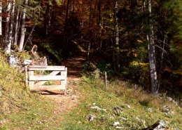 https://www.achental.com/en/storage/sites/10/2025/11/46066_DSC00052.jpg
1200
1600
admin
https://www.achental.com/wp-content/uploads/2022/07/achental-logo-weiss-horizontal-RGB@2x.png
admin2025-08-21 01:03:332025-11-09 18:23:29Rechenbergalm via Feldlahnalm – alpine pasture hike
https://www.achental.com/en/storage/sites/10/2025/11/46066_DSC00052.jpg
1200
1600
admin
https://www.achental.com/wp-content/uploads/2022/07/achental-logo-weiss-horizontal-RGB@2x.png
admin2025-08-21 01:03:332025-11-09 18:23:29Rechenbergalm via Feldlahnalm – alpine pasture hike https://www.achental.com/en/storage/sites/10/2025/11/FtSWZN9M0ChfgshlsmuZf0t0Ne2QGzRvjNBdKk9u.jpg
1707
2560
admin
https://www.achental.com/wp-content/uploads/2022/07/achental-logo-weiss-horizontal-RGB@2x.png
admin2025-08-11 01:05:532025-11-09 18:37:00Lake Taubensee via Chiemhauser Alm and Kroatensteig trail by bus 9505
https://www.achental.com/en/storage/sites/10/2025/11/FtSWZN9M0ChfgshlsmuZf0t0Ne2QGzRvjNBdKk9u.jpg
1707
2560
admin
https://www.achental.com/wp-content/uploads/2022/07/achental-logo-weiss-horizontal-RGB@2x.png
admin2025-08-11 01:05:532025-11-09 18:37:00Lake Taubensee via Chiemhauser Alm and Kroatensteig trail by bus 9505 https://www.achental.com/en/storage/sites/10/2025/11/hLkmKOrfGxxgBgRO4D7XuI0tzLw8lJQ9CQnYTHMQ.jpeg
1707
2560
admin
https://www.achental.com/wp-content/uploads/2022/07/achental-logo-weiss-horizontal-RGB@2x.png
admin2025-08-11 01:05:532025-11-09 18:42:35From Streichenkirche church via Kroatensteig trail to lake Taubensee and Reit im Winkl
https://www.achental.com/en/storage/sites/10/2025/11/hLkmKOrfGxxgBgRO4D7XuI0tzLw8lJQ9CQnYTHMQ.jpeg
1707
2560
admin
https://www.achental.com/wp-content/uploads/2022/07/achental-logo-weiss-horizontal-RGB@2x.png
admin2025-08-11 01:05:532025-11-09 18:42:35From Streichenkirche church via Kroatensteig trail to lake Taubensee and Reit im Winkl https://www.achental.com/en/storage/sites/10/2025/11/51253_DSC00673_1920x1278.jpg
1278
1920
admin
https://www.achental.com/wp-content/uploads/2022/07/achental-logo-weiss-horizontal-RGB@2x.png
admin2025-06-03 13:34:102025-11-09 18:26:34Circular tour Grassauer Almen
https://www.achental.com/en/storage/sites/10/2025/11/51253_DSC00673_1920x1278.jpg
1278
1920
admin
https://www.achental.com/wp-content/uploads/2022/07/achental-logo-weiss-horizontal-RGB@2x.png
admin2025-06-03 13:34:102025-11-09 18:26:34Circular tour Grassauer Almen https://www.achental.com/en/storage/sites/10/2025/11/O21Vpg7I3tdx4p88HDXlbarPniW4tzwplfeHTrBj.jpg
2560
1920
admin
https://www.achental.com/wp-content/uploads/2022/07/achental-logo-weiss-horizontal-RGB@2x.png
admin2025-04-30 09:21:542025-11-09 18:26:51Circular tour Vorderalm – Brachtalm – Staudacher Alm
https://www.achental.com/en/storage/sites/10/2025/11/O21Vpg7I3tdx4p88HDXlbarPniW4tzwplfeHTrBj.jpg
2560
1920
admin
https://www.achental.com/wp-content/uploads/2022/07/achental-logo-weiss-horizontal-RGB@2x.png
admin2025-04-30 09:21:542025-11-09 18:26:51Circular tour Vorderalm – Brachtalm – Staudacher Alm https://www.achental.com/en/storage/sites/10/2025/11/KKX9UDoPV12aMw9wvyEJ367aiX6VkZbBz3SUeNbQ.jpg
1707
2560
admin
https://www.achental.com/wp-content/uploads/2022/07/achental-logo-weiss-horizontal-RGB@2x.png
admin2025-04-14 01:03:592025-11-09 18:42:23Über die Chiemhauseralm zur Streichenkirche
https://www.achental.com/en/storage/sites/10/2025/11/KKX9UDoPV12aMw9wvyEJ367aiX6VkZbBz3SUeNbQ.jpg
1707
2560
admin
https://www.achental.com/wp-content/uploads/2022/07/achental-logo-weiss-horizontal-RGB@2x.png
admin2025-04-14 01:03:592025-11-09 18:42:23Über die Chiemhauseralm zur Streichenkirche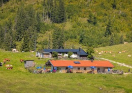 https://www.achental.com/en/storage/sites/10/2025/11/uUnvDBePtrwGxcf8hbdGtCLbYq6bvqClVXDV3WE1.jpg
1707
2560
admin
https://www.achental.com/wp-content/uploads/2022/07/achental-logo-weiss-horizontal-RGB@2x.png
admin2024-12-20 01:05:522025-11-09 18:40:30Via Rechenbergalm to Jochbergalm
https://www.achental.com/en/storage/sites/10/2025/11/uUnvDBePtrwGxcf8hbdGtCLbYq6bvqClVXDV3WE1.jpg
1707
2560
admin
https://www.achental.com/wp-content/uploads/2022/07/achental-logo-weiss-horizontal-RGB@2x.png
admin2024-12-20 01:05:522025-11-09 18:40:30Via Rechenbergalm to Jochbergalm https://www.achental.com/en/storage/sites/10/2025/11/gJdP8ClRDrDHLBCNGi82ujnTR5rt7siKdffRvoAY.jpg
1920
1440
admin
https://www.achental.com/wp-content/uploads/2022/07/achental-logo-weiss-horizontal-RGB@2x.png
admin2024-12-20 01:05:502025-11-09 18:39:54Über die Bäcker-Alm zum Streichen
https://www.achental.com/en/storage/sites/10/2025/11/gJdP8ClRDrDHLBCNGi82ujnTR5rt7siKdffRvoAY.jpg
1920
1440
admin
https://www.achental.com/wp-content/uploads/2022/07/achental-logo-weiss-horizontal-RGB@2x.png
admin2024-12-20 01:05:502025-11-09 18:39:54Über die Bäcker-Alm zum Streichen https://www.achental.com/en/storage/sites/10/2025/11/Mzbvkr2CVhjK2elYUvMyzVhNyuNFaMI5cyF0se8D.jpg
1920
2560
admin
https://www.achental.com/wp-content/uploads/2022/07/achental-logo-weiss-horizontal-RGB@2x.png
admin2024-12-20 01:05:502025-11-09 18:35:03Lake Taubensee
https://www.achental.com/en/storage/sites/10/2025/11/Mzbvkr2CVhjK2elYUvMyzVhNyuNFaMI5cyF0se8D.jpg
1920
2560
admin
https://www.achental.com/wp-content/uploads/2022/07/achental-logo-weiss-horizontal-RGB@2x.png
admin2024-12-20 01:05:502025-11-09 18:35:03Lake Taubensee https://www.achental.com/en/storage/sites/10/2025/11/74094_donauer_alm_2.jpg
695
1024
admin
https://www.achental.com/wp-content/uploads/2022/07/achental-logo-weiss-horizontal-RGB@2x.png
admin2024-12-20 01:05:502025-11-09 18:08:45Chiemhauser Alm
https://www.achental.com/en/storage/sites/10/2025/11/74094_donauer_alm_2.jpg
695
1024
admin
https://www.achental.com/wp-content/uploads/2022/07/achental-logo-weiss-horizontal-RGB@2x.png
admin2024-12-20 01:05:502025-11-09 18:08:45Chiemhauser Alm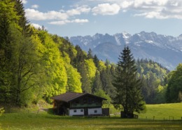 https://www.achental.com/en/storage/sites/10/2025/11/ItTnCDU9yCrNYHUmASlZ20ur1tcSbjV4oZ48M1k1.jpg
1707
2560
admin
https://www.achental.com/wp-content/uploads/2022/07/achental-logo-weiss-horizontal-RGB@2x.png
admin2024-12-20 01:05:492025-11-09 18:34:31Streichen-Rundweg
https://www.achental.com/en/storage/sites/10/2025/11/ItTnCDU9yCrNYHUmASlZ20ur1tcSbjV4oZ48M1k1.jpg
1707
2560
admin
https://www.achental.com/wp-content/uploads/2022/07/achental-logo-weiss-horizontal-RGB@2x.png
admin2024-12-20 01:05:492025-11-09 18:34:31Streichen-Rundweg https://www.achental.com/en/storage/sites/10/2025/11/ziQwq0pPYOBOMd0WINaaZ5FpplZX64CEVeW4xFCH.jpg
1708
2560
admin
https://www.achental.com/wp-content/uploads/2022/07/achental-logo-weiss-horizontal-RGB@2x.png
admin2024-12-20 01:05:482025-11-09 18:43:51Hike to Jochberg-Almen
https://www.achental.com/en/storage/sites/10/2025/11/ziQwq0pPYOBOMd0WINaaZ5FpplZX64CEVeW4xFCH.jpg
1708
2560
admin
https://www.achental.com/wp-content/uploads/2022/07/achental-logo-weiss-horizontal-RGB@2x.png
admin2024-12-20 01:05:482025-11-09 18:43:51Hike to Jochberg-Almen https://www.achental.com/en/storage/sites/10/2025/11/chxdssGBO9ixM3bDr5RlpxG8l8WhiV4tRsRkGxh0.jpg
1920
2560
admin
https://www.achental.com/wp-content/uploads/2022/07/achental-logo-weiss-horizontal-RGB@2x.png
admin2024-12-20 01:05:462025-11-09 18:33:19Sonnenalm next to Kampenwand
https://www.achental.com/en/storage/sites/10/2025/11/chxdssGBO9ixM3bDr5RlpxG8l8WhiV4tRsRkGxh0.jpg
1920
2560
admin
https://www.achental.com/wp-content/uploads/2022/07/achental-logo-weiss-horizontal-RGB@2x.png
admin2024-12-20 01:05:462025-11-09 18:33:19Sonnenalm next to Kampenwand https://www.achental.com/en/storage/sites/10/2025/11/yUw8PLXBlAjjKN8TVNqSikEDU3Kw4SyjH9jycrJs.jpg
853
1138
admin
https://www.achental.com/wp-content/uploads/2022/07/achental-logo-weiss-horizontal-RGB@2x.png
admin2024-12-20 01:05:452025-11-09 18:25:01Circular tour via Rachl-Alm and Hefter-Alm
https://www.achental.com/en/storage/sites/10/2025/11/yUw8PLXBlAjjKN8TVNqSikEDU3Kw4SyjH9jycrJs.jpg
853
1138
admin
https://www.achental.com/wp-content/uploads/2022/07/achental-logo-weiss-horizontal-RGB@2x.png
admin2024-12-20 01:05:452025-11-09 18:25:01Circular tour via Rachl-Alm and Hefter-Alm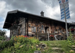 https://www.achental.com/en/storage/sites/10/2025/11/OiLEelphZLFgcwrwcZGmXchQQkr11ul7qUt1F09C.jpg
2560
1920
admin
https://www.achental.com/wp-content/uploads/2022/07/achental-logo-weiss-horizontal-RGB@2x.png
admin2024-12-20 01:05:452025-11-09 18:36:26via Aßberg- and Stoibenmöseralm to Lake Taubensee
https://www.achental.com/en/storage/sites/10/2025/11/OiLEelphZLFgcwrwcZGmXchQQkr11ul7qUt1F09C.jpg
2560
1920
admin
https://www.achental.com/wp-content/uploads/2022/07/achental-logo-weiss-horizontal-RGB@2x.png
admin2024-12-20 01:05:452025-11-09 18:36:26via Aßberg- and Stoibenmöseralm to Lake Taubensee https://www.achental.com/en/storage/sites/10/2025/11/9YeF5XO9RWxk6Z3MVGlkOPJf5dmRinGzijZgskQK.jpg
1552
2560
admin
https://www.achental.com/wp-content/uploads/2022/07/achental-logo-weiss-horizontal-RGB@2x.png
admin2024-12-20 01:05:442025-11-09 18:27:19Circular trail Hochgern-Staudacheralm-Schnappenkirche
https://www.achental.com/en/storage/sites/10/2025/11/9YeF5XO9RWxk6Z3MVGlkOPJf5dmRinGzijZgskQK.jpg
1552
2560
admin
https://www.achental.com/wp-content/uploads/2022/07/achental-logo-weiss-horizontal-RGB@2x.png
admin2024-12-20 01:05:442025-11-09 18:27:19Circular trail Hochgern-Staudacheralm-Schnappenkirche

 Dalsen-Alm